From the Pomposa Abbey to Porto Garibald
from Pomposa to Porto Garibaldi: 25 km, 6 hours
Download the kmz file which can be opened with google earth
Route from the Pomposa Abbey to Porto Garibaldi
From the Pomposa Abbey to Porto Garibaldi
Distance: 25 Km
Time: 6 h
From the Abbey of Pomposa in the Municipality of Codigoro, follow the road to the east of the Giralda valley to reach the old Via Corriere street, which was the first road in the area bordering the Bola della Mesola between humps and valleys, turning right towards south towards Volano. We will cross a bridge on the idrovara della Falce, a locality called Taglio della Falce, a toponym that recalls the shape of the Sacca di Goro which is wedged in the Boscone della Mesola. Continue in the stupendous residual valley called Porticino, to arrive, leave to your left the church of hexagonal shape in Volano often closed but in the Abbey of Pomposa can indicate the openings and crossing the Po di Volano, you get to the Lido di Volano in the town of Comacchio.
Pomposa2We will turn left to the east to arrive in the forest of Volano, which was part of the Mesola wood that continued after the Cut of the Sickle. We will not drive all the way to the beaches, but we will turn right south into the forest path that crosses the forest perpendicularly. We will not often see the sky because submerged by maritime pines, oaks and holm oaks, we must not be particularly lucky but silent to see herds of deer and roe deer living in the woods. We will arrive or rather we will come out on the sea, here natural.
This itinerary includes the passage to the shore of the Nations following the beach to avoid the road and according to the period the holiday traffic. We will coast the beach
always in a southerly direction, passing from the lido delle Nazioni, Lido di Pomposa, Lido Pomposa3degli Scacchi to get to Porto Garibaldi. We will go back to the beach to get into Via dei Mille turning west for a short stretch to turn in the path to the south leading to Via Salemi, we will cross it, we will arrive in via Giuseppe Bandi then in via Giovane Italia, we will arrive in via Mentana, we will turn to left then to the right taking via Nino Bixio. Via Maggiore Leggero and Via Caiazzo will take us to Viale Nino Bonnet, we will turn right and in a hundred meters we will arrive at the end of the stage, near the Church of Porto Garibaldi.
Where to stay and eat, take the stamps, useful materials.
Pomposa Abbey: possibility of sleeping by calling the Friars Reconstructors in the Prayer, for the stamps to go to the opening hours in the parish office. http://www.iricostruttori.com/ricerca-nelle-regioni/emilia-romagna/abbazia-di-pomposa-codigoro-ferrara
Contact person: Gianpaolo Contra: 328 7677920
Information office and tourist reception: 0533 719110
Places of interest
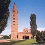
Pomposa The Pomposiana insula, already known in antiquity, was originally surrounded by water (the Po di Goro, Po di Volano and the sea). There is news of a Benedictine abbey, smaller than the current one, starting from the ninth century, but the settlement of the first monastic community in the Pomposa Insula dates back to the VI-VII century, founded in the Longobard era by the monks of San Colombano that they erected a chapel. The first historical document attesting to the existence of the abbey is in any case of the ninth century: mention is made of the fragment of a letter that Pope John VIII sent to Emperor Ludwig II.
We also know that in 981 it passed to the Pavia monastery of San Salvatore, and that eighteen years later it was under the jurisdiction of the archdiocese of Ravenna, freeing itself later and enjoying, thanks to private donations, a period of great flowering.
The abbey we admire today was consecrated in 1026 (then built before) by Abbot Guido. At the basilica the magister Mazulo added in those years a narthex with three large arches.
Until the fourteenth century the abbey enjoyed ownership, both in the surrounding land (including a saltworks in Comacchio), and in the rest of Italy, thanks to donations; then it had a slow decline, due to geographical and environmental factors, such as malaria and the swamping of the area, also caused by the deviation of the Po riverbed (route of Ficarolo, 1152).
It was of great importance for the preservation and dissemination of culture during the Middle Ages, thanks to the scribal monks who resided there. In this abbey the monk Guido d’Arezzo conceived the modern musical notation and fixed the name of the musical notes. Between 1040 and 1042 the ravennate Pier Damiani also stayed there, called to instruct the monks.
In 1653 Pope Innocent X suppressed the monastery, which in 1802 was bought by the family of Ravenna Guiccioli. At the end of the nineteenth century the property passed to the Italian State, it is currently under management at the Emilia Romagna Museum Complex. And for details see the regional website EMILIA ROMAGNA TOURISM, the official tourist information site of the region; www.emiliaromagnaturismo.it
Wood of the Mesola
The Natural Reserve of the Gran Bosco della Mesola, with an area of 1,058 hectares, is one of the last and best preserved remains of lowland forest, memory of the ancient forests that were found until a few centuries ago along the Adriatic coast.
Probably originated in the Middle Ages on dune strings formed by the Po di Goro and Po di Volano, the Bosco della Mesola is today the most extensive wooded area in the province of Ferrara. The land is of alluvial origin and has an irregular pattern, a symptom of the presence of ancient dunes, which at times form stagnations of water, with marsh vegetation. Once the wood, surrounded by marshes, welcomed many varieties of birds, typical of wetlands; the drastic reduction of the fauna, caused by the draining works, has been slowed down with the creation of a wetland area inside the forest, called Elciola, generally closed to the public where they find shelter anatids and herons.
Notes for the visit: The forest is not entirely open to visitors, but authorized trails allow you to spot deer and fallow deer. It can be accessed on foot or by bicycle.
In the woods there is an educational path of about 500 meters for the blind, equipped with a handrail and tables in the Braille alphabet that help to understand the various plant and fauna species present in the oasis.
Wood of Volano
The environment
The identified area includes the area of the Po di Volano mouth from the bridge of Volano at the outlet in Sacca di Goro and the environment called Peschiere and what remains of the southern portion of the former Valle Falce. The Po di Volano river mouth is divided into two branches, both facing north-east, that is towards the inside of the Sacca di Goro. The easternmost branch has recently been separated from Volano and divided into trunks, with precarious intercommunication, the western branch is the current active mouth and laps, with its left bank, the Peschiere. These are a salt marsh in direct contact with the sea at the Taglio della Falce. The Cut of the Scythe consists of a marine inlet located immediately north of the mouth of the Volano and which limits to S the Bosco della Mesola. It represents the lagoon mouth through which the Giralda Valley (reclaimed in 1960) and the Valle Falce (dried up in 1969) communicated with the Sacca di Goro and then with the sea.
The drying up of Valle Falce caused a strong lowering of the water table and the consequent death of the most ancient specimens of the neighboring Bosco della Mesola. This last swamp (together with two other small ponds adjacent to the Valle Canevié) constitutes the Oasis of Foce Volano. The waters have salinity generally quite low because, despite the area is in communication with the mouth of the Sacca di Goro, they are very affected by the supply of fresh water from Po di Volano (Bondesan in Corbetta 1990).
The flora
The Foce del Po di Volano, the Peschiere and the Cut of the Scythe and are characterized by a reed bark at Phragmites australis and by a few mirrors of open water, there are also prairies at Ruppia cirrhosa. In the area bordering the Scaglio della Falce, a salt meadow at Juncus maritimus (Sint Puccinellio festuciformis-Juncetum maritimi) accompanied by Aster tripolium, Limomnium serotinum, Puccinellia palustris, and a small thermophilic patch (Sint. Quercion ilicis) dominated by holm oak (Quercus ilex) is also characterized by Phillyrea angustifolia, Asparagus acutifolius, Clematis flammula, Rubia peregrina, Ruscus aculeatus, Osiris alba and Rosa sempervirens, mixed with mesophilous species (Corticelli 1999, Pellizzari and Pagnoni 1998).
Fauna
One of the most important red heron colonies in Italy (210 couples) has been established in the reeds of the river mouth (Peschiere area). Po di Volano is an important climbing area for the cheppia (Alosa fallax ssp. Nilotica). In addition, in the stretch of fresh water lives an abundant population of roach, while at the mouth there are gray goby and goby lagoon. The marsh harrier (Costa 1998) also nests in the reeds.
Porto Garibaldi
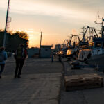
called Magnavacca fraction of Comacchio with about 4000 inhabitants. The old toponym presumably derived from the Latin Magno Vacuum, The Great Emptiness. Rione Magnavacca means the oldest district of the current Porto Garibaldi, which in Roman times was called Magnum Vacum, then in medieval times changed to Portum Majavache, and around the seventeenth century of Magnavacca and finally in 1919 in Porto Garibaldi, in honor of the landing and its salvation of Giuseppe Garibaldi and Anita (3 August 1849).
Around 1600 the first masonry buildings were built, among them: the watchtower called Torre Bianca or Torre Lambertini, the Bettolino, the house of Conte Ciabatta (governor of the port), that of the Dazio, the Faro operator, the warehouses of salt, plus some wells for the supply of fresh water for the residents an
d for the fishermen who landed there and whoever else used it.
In the nineteenth century erected the building of the Customs and Delegation of Porto, the houses of the owners of agricultural funds: Bonnet, Felletti Spadazzi, Bellini, Bergamini, Patrignani and others. The new Parish Church, the Mazzini Club, the elementary schools, the hospital for the sick in absentia, some taverns, an inn, the post office and a bathhouse, a bread oven and numerous single-story houses with marsh reed roofs (called Casoni).
