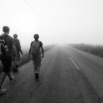
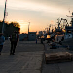
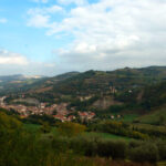
from Porto Garibaldi to Madonna del Bosco: 25 km, 6 hours
Stage number 2: from Porto Garibaldi to the Sanctuary of the Madonna del Bosco
Distance: 25 Km
Time: 7 h
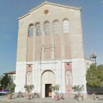
From the church of the Immaculate Conception of Maria di Porto Garibaldi, you will pass through PortoGaribaldiviale Nino Bonnet to take Via Teano to reach Via Matteotti – Caduti del Mare and take the ferry to Lido degli Estensi. This stretch winds through the city streets, where there are still sidewalks, from Via Torquato Tasso you get to Viale Alessandro Manzoni, continue along via Giacomo Leopardi, you will pass in front of the marina Marina degli Estensi, to arrive in via Cagliari. Via Cagliari will take us out of the town and passing under the busy Albani bridge we will continue on Via della Corriera Antica along the Pallotta canal. We begin to feel the silence and the smell of the valleys. At the height of the Balley allied bridge, continue along the canal embankment until you reach a clearing where there is now a clam fishermen’s port.
You will climb on the bridge – motorized sluice gates for the inflow of the water in the valleys and you will begin to walk the path, first on the covered slopes of Salicornia in the west direction then climbing on the embankment that divides the canal pallotta with a view on the saltworks of Comacchio www.ferraraterraeacqua.it/it/comacchio/discover-the-territory/ ambientee-natura / parco-riserva-naturale / lasalina-parco-delta-del-po
Continue on the embankment in the direction of Foce Station, Comacchio Valley of Comacchio, and we will not take your eyes off the flocks of pink flamingos that stand between bumps and valleys.
http://www.ferraraterraeacqua.it/it/comacchio/scopri-il-territorio/ambiente-e-natura/parchi-riserve-naturali/valli-di-comacchio-parco-delta-del-po
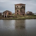
And the renovated farmhouse Bettolino di Foce, today a trattoria and a point of support for refilling and filling the water bottles. Then, continue in the direction of Comacchio arriving at another bridge Balley, and even leaving this on the right we will continue on a beautiful embankment that will lead us to the locality Fosse.
Just past the bar on the left you will see the ruins of a house that is served for the shooting of the film Agnese goes to Dying by Giuliano Montaldo. We will continue and on the left the valley will appear in its size. Halfway along the embankment we will meet the Donnabona house and then the ruins of the Caldirolo house. Arrived PortoGaribaldi5 all’idrovoro of Fosse, large structure created to reclaim the great valley of the Mezzano and now helps to keep the lands below sea level, we will turn left along the road, not very busy called Agosta bank, which divided right the valley of the Mezzano, today reclaimed, and on the left the valley remained, leaving on the left the guardian station Fosse.
We will drive along the Agosta road for about 8.5 km, having a hat if it beats the sun, or a good piece of equipment if it is raining or windy, because it is a stretch discovered.
We will reach the Umana Umana di Anita to the right, we will continue straight ahead, passing the deviation that would lead to the left on the Reno ferry to Sant’Alberto and the wonderful area called Prato Pozzo. To reach a 90 ° bend where we will continue straight on via Casso Madonna. A bizarre name that indicates the expansion tanks of the River Rhine, where water is channeled in the event of flooding. The road becomes a dirt road and will take us going furt
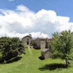
her forwardPortoGaribaldi6 first right then left on the bank of the river Reno, where we will continue until we reach the bridge that we will cross in the direction of Alfonsine. 500 meters after the bridge, on the right, we will arrive at the Sanctuary of the Madonna del Bosco, the final stage and a resting place for the members and for the mind.
http://alfonsinemonamour.racine.ra.it/alfonsine/Alfonsine/madonnaboschi.htm
Where to stay and eat, take the stamps, useful materials.
Porto Garibaldi: possibility to sleep by calling the parish priest Don Andre Nayeton 345 3069559, for the stamps to go to the opening hours in the parish office.
Referent: Umberto Carli 366 3742870
Comacchio Tourist Office: 0533 314154
Places of interest
Porto Garibaldi
Called Magnavacca fraction of Comacchio with about 4000 inhabitants. The old toponym presumably derived from the Latin Magno Vacuum, The Great Emptiness. Rione Magnavacca means the oldest district of the current Porto Garibaldi, which in Roman times was called Magnum Vacum, then in medieval times changed to Portum Majavache, and around the seventeenth century of Magnavacca and finally in 1919 in Porto Garibaldi, in honor of the landing and its salvation of Giuseppe Garibaldi and Anita (3 August 1849).
Around 1600 the first masonry buildings were built, among them: the watchtower called Torre Bianca or Torre Lambertini, the Bettolino, the house of Conte Ciabatta (governor of the port), that of the Dazio, the Faro operator, the warehouses of salt, plus some wells for the supply of fresh water for the residents and for the fishermen who landed there and whoever else used it.
In the nineteenth century erected the building of the Customs and Delegation of Porto, the houses of the owners of agricultural funds: Bonnet, Felletti Spadazzi, Bellini, Bergamini, Patrignani and others. The new Parish Church, the Mazzini Club, the elementary schools, the hospital for the sick in absentia, some taverns, an inn, the post office and a bathhouse, a bread oven and numerous single-storey houses with marsh reed roofs (called Casoni).
Comacchio
“… and the city in the midst of the swampy marshes of the Po fears both the mouths, where the unhappy people dwell, that the sea is disturbed and the atrocious winds are.”(Ludovico Ariosto, Orlando furious, III, 41).
It is under the landscape and historical aspect one of the major centers of the Po delta. It originates about two thousand years ago, during its history it was subjected to the power of the first Exarchate of Ravenna, the Duchy of Ferrara later, and then return to be part of the territories of the Papal State.
The etymology of the name is uncertain (Greek-Latin cumaculum = “small wave”; “grouping of bumps” in Etruscan). The foundation is attributed to the Etruscans, who were already settled in the Po Delta. Near Comacchio there was in fact the Etruscan city of Spina.
Built on the union of thirteen small islands (coastal dune stretches) formed by the intersection of the mouth of the Po di Primaro with the sea, it had to direct its development, both in terms of urbanism and the economy, on the element of water.
Following the fall of the Western Roman Empire, Comacchio became part of the Exarchate of Italy The first bishop of the city whose memory was Pagaziano (mentioned in 503 and 504). Comacchio then passed under the Lombard Kingdom after the Chapter of Liutprando of 715 (which describes the rules and taxes charged to Comacchio in order to exercise the salt trade in the regions of the Po Valley subjected to the Longobard authority).
In the Lombard period the territory was donated to the monks of San Colombano; it thus became a possession of the great monastic feud of Bobbio. The monks installed the river port there, they also developed agriculture and livestock. Finally they improved the exploitation of the salt pans, whose salt was transported throughout the northern part of Italy. Between the 6th and 9th centuries Comacchio had one of the most powerful fleets of the Adriatic entering directly into competition with Venice.
But Venice did not accept the presence of an adversary in the same geographical area. In the year 866 the Venetians occupied Comacchio and looted it for the first time. In 875 Venice itself was threatened by raids by the Saracens, who flung themselves against Comacchio, setting it on fire.
Five times in the early Middle Ages Comacchio was besieged and taken by the maritime republic, until it came under the domination of the Estensi in 1299.
With the extinction of the Este dynasty, in 1598 it returned under the jurisdiction of the Church, which placed it in the newly formed Legation of Ferrara. Comacchio was part of the Papal State until March 1860, when the territories of the former Legations were annexed to the Kingdom of Sardinia as a result of the plebiscites.
The bridges are the qualifying element of the historic center of Comacchio, given that the ancient town was located on small islands connected to each other.
Trepponti architectural complex. Created in 1634 by architect Luca Danesi, it consists of five wide staircases (three front and two rear), culminating in an Istrian stone floor; it is the symbol of Comacchio.
Ponte degli Sbirri, seventeenth-century Palazzo Bellini, nineteenth-century, houses the Gallery of Contemporary Art, the Historical Archive, the library and the offices of the cultural institutions.
Museum of the Cargo of the Roman Ship, houses the cargo of a commercial ship of the imperial era, re-emerged in 1981 during the drainage of a canal. The ship, in exceptional state of conservation, still contained all the cargo (amphorae with foodstuffs, lead ingots, some votive lead times). The entire cargo as well as the equipment and clothing of the crew are exhibited in the museum, along with a reconstruction of the ship. In fact, in 2016, 35 years after the find, the wreck is still undergoing “restoration” and “consolidation” and its vision is forbidden to the public.
Clock Tower (dating back to the fourteenth century).
Loggia dei Mercanti or Grano.
San Camillo Hospital, home to the Museo del Delta Antico.
Loggiato dei Cappuccini, consisting of 142 arches supported by as many marble columns and over 400 meters long.
The Park Visitor Center of the Po Delta organizes excursions in the Valli di Comacchio, to show the ancient management practices of the valley, fishing and marinating the eels and the acquads, and contrasting the poaching. Inside the Manifattura dei Marinati you can see the ancient chimneys, the fryers for the acquardelle, the rooms and the tools for the treatment and storage of the fish.

